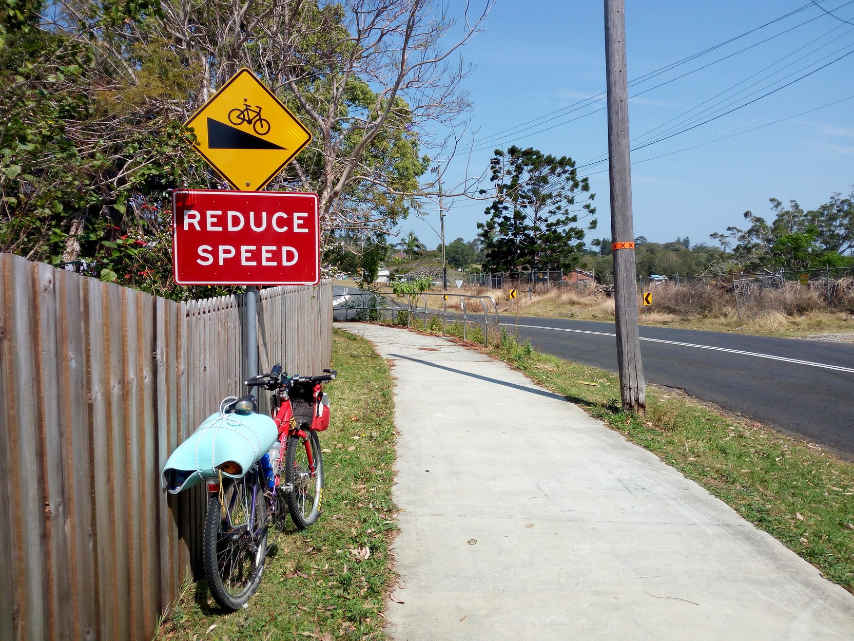
Byron Bay to Coffs Harbour, the "back way", Sept. 2017 (1/2)This is Page one, here is the introduction and the map and page two. Remember that the TABE(*) route shown was the provisional route that has changed. Day 1 (23 Sept. 11:28AM start!) Byron Bay to Ballina
Summary: Day one was really a half day. It ended up being an easy bicycle ride from Byron Bay to a few km past Woodburn - about 92km. I stopped a lot for photos, fixed a flat, and had a good tailwind for most of the day. (*) The GPS route I followed was a section of the provisional (2018) Terra Australis Bicycle Epic (TABE) route. It's a Saturday morning and the start point was Byron Bay, and we are driving from Coffs Harbour by car. It was late in the morning when we arrived, so we decided to drive up to the lighthouse (the headland is the most easterly mainland point in Australia). The plan was that I would turn on my tracking device (a Bryton 310) and then cycle out of the heavy school holiday traffic and start my bicycle ride south to Coffs Harbour. The basic plan was to first quickly do the roughly 35 km to Ballina via Lennox Head and some of the smaller hamlets along the way - if there was a problem I hoped to be able to sort it out at Ballina. My wife had family business at Currumbin just over the border less than an hour north. I could possibly catch a lift with her south of Grafton on her way back to Coffs in two day's time. The road south, out of Byron Bay was mostly good with on-road cycle paths in the built up areas. Sometimes the cycling verge was narrow but sight lines were good. First photo shows the turn west to Bangalow.
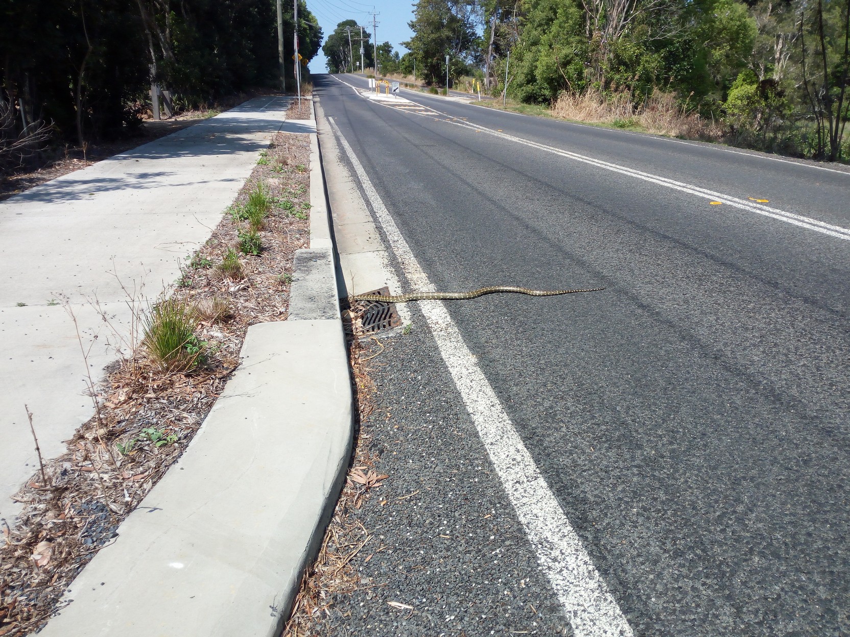
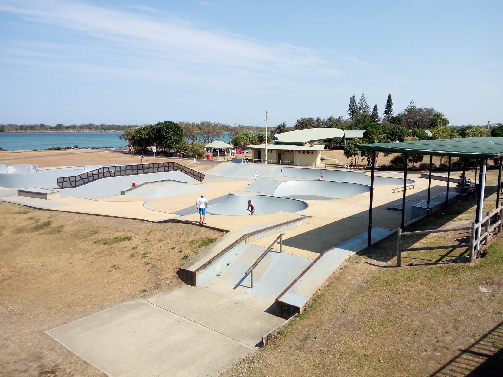
There were lots of things to see including a 2.5m diamond python slithering into a culvert (a crazy 4x4 driver nearly lost control right in front of me trying to avoid it), some beaches, lush panoramas, and Ballina Skate park just over the bridge from Hill Street, almost at the start of the Ballina CBD.
|
Ballina to Broadwater via cane fields & Pacific Highway
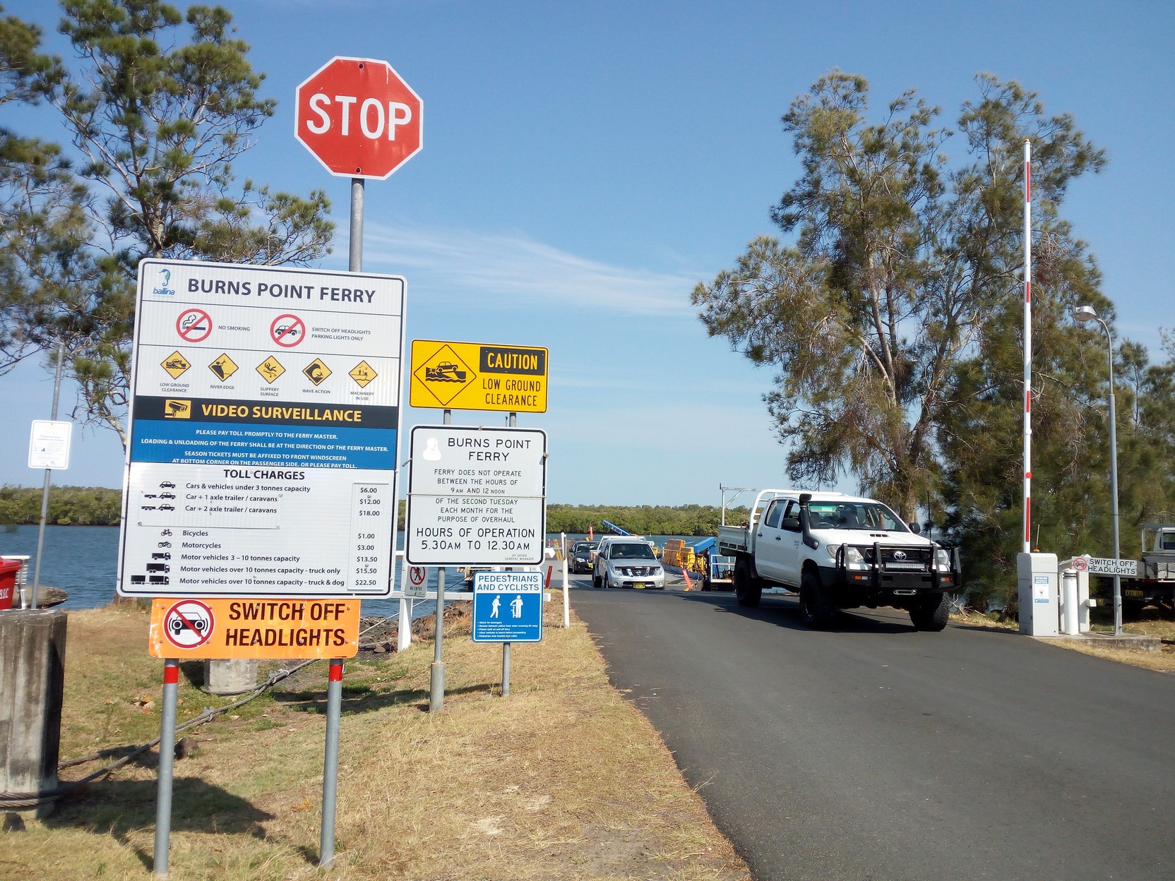
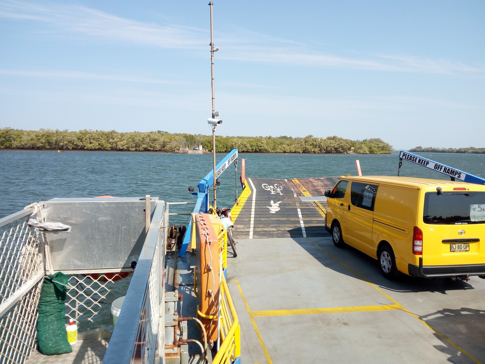
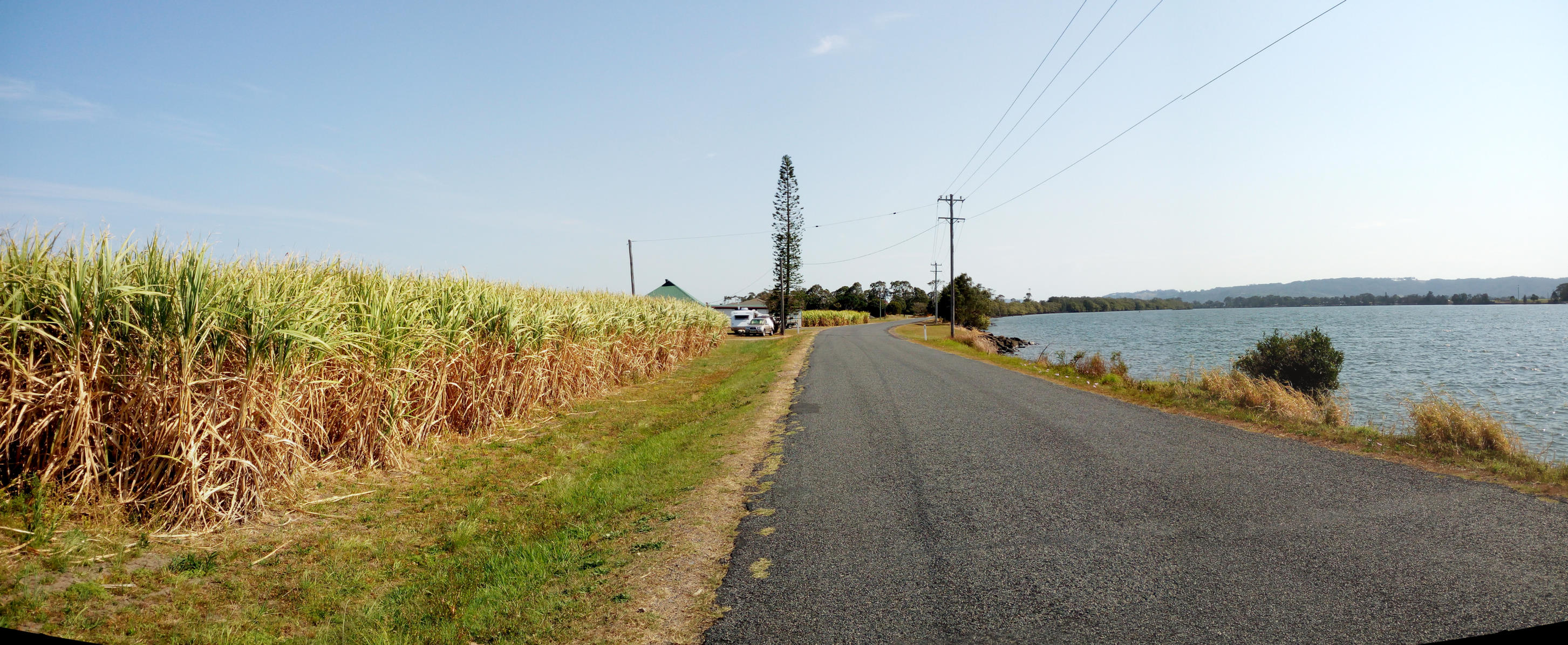
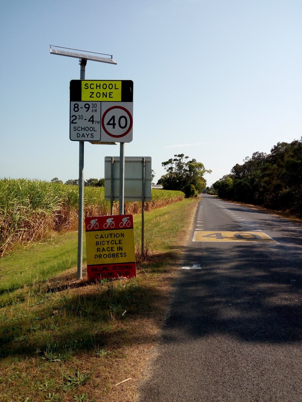
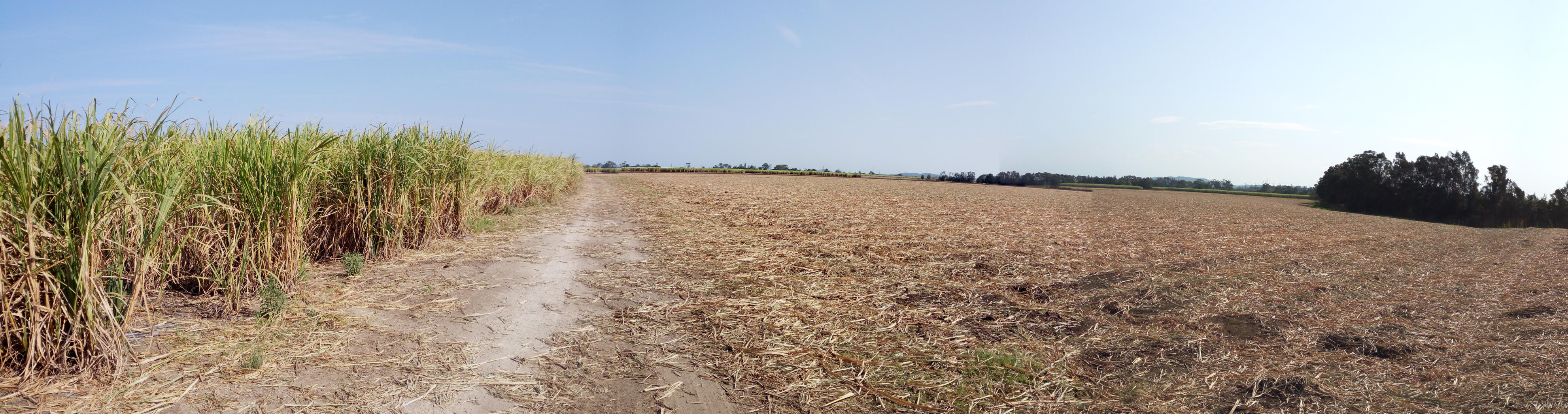
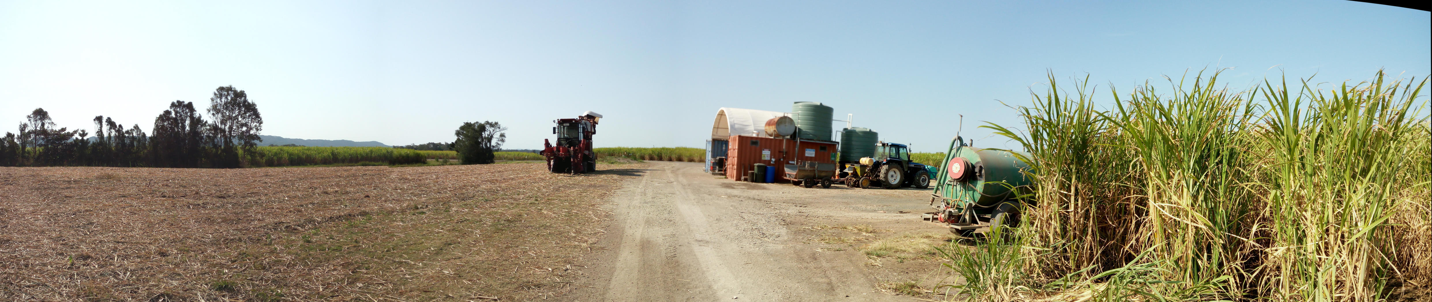
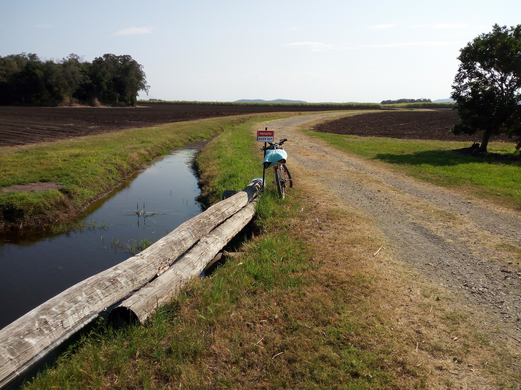
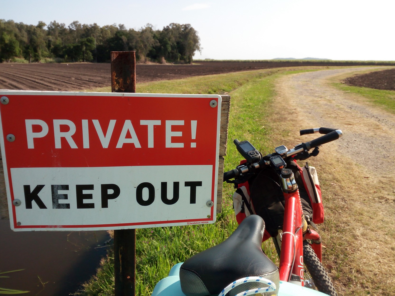
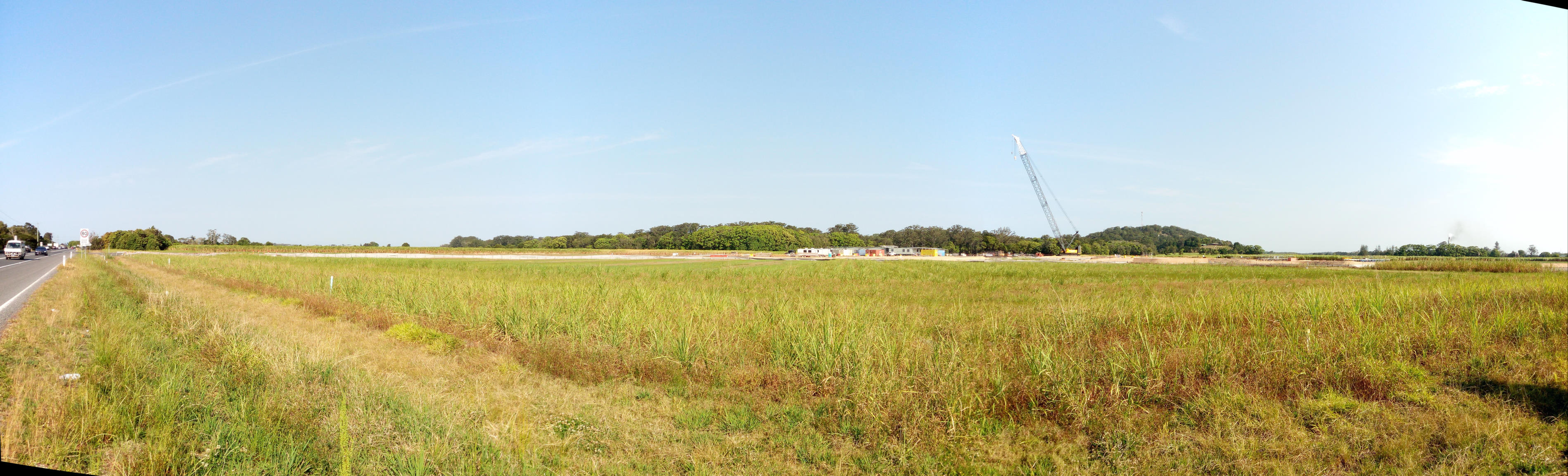
As it turned out, by the time I cycled to Ballina all the cycle places there had closed and I found myself without any bicycle tube patches (but no flats yet)! But I was able to buy some coffee and fill up my water (about 2.4 L in three biddons). Cycling west and south through Ballina I arrived around 2:00 PM at South Ballina's Burns Point Ferry that crosses the short distance to River Drive on the southern bank of the Richmond River. Cost was just $1.00 for bicycles for the 300 m journey. On the other side, after a few hundred metres of mud-flat, it's into rural north coast NSW - cane fields and other crops relying on fertile soil and a good water supply.
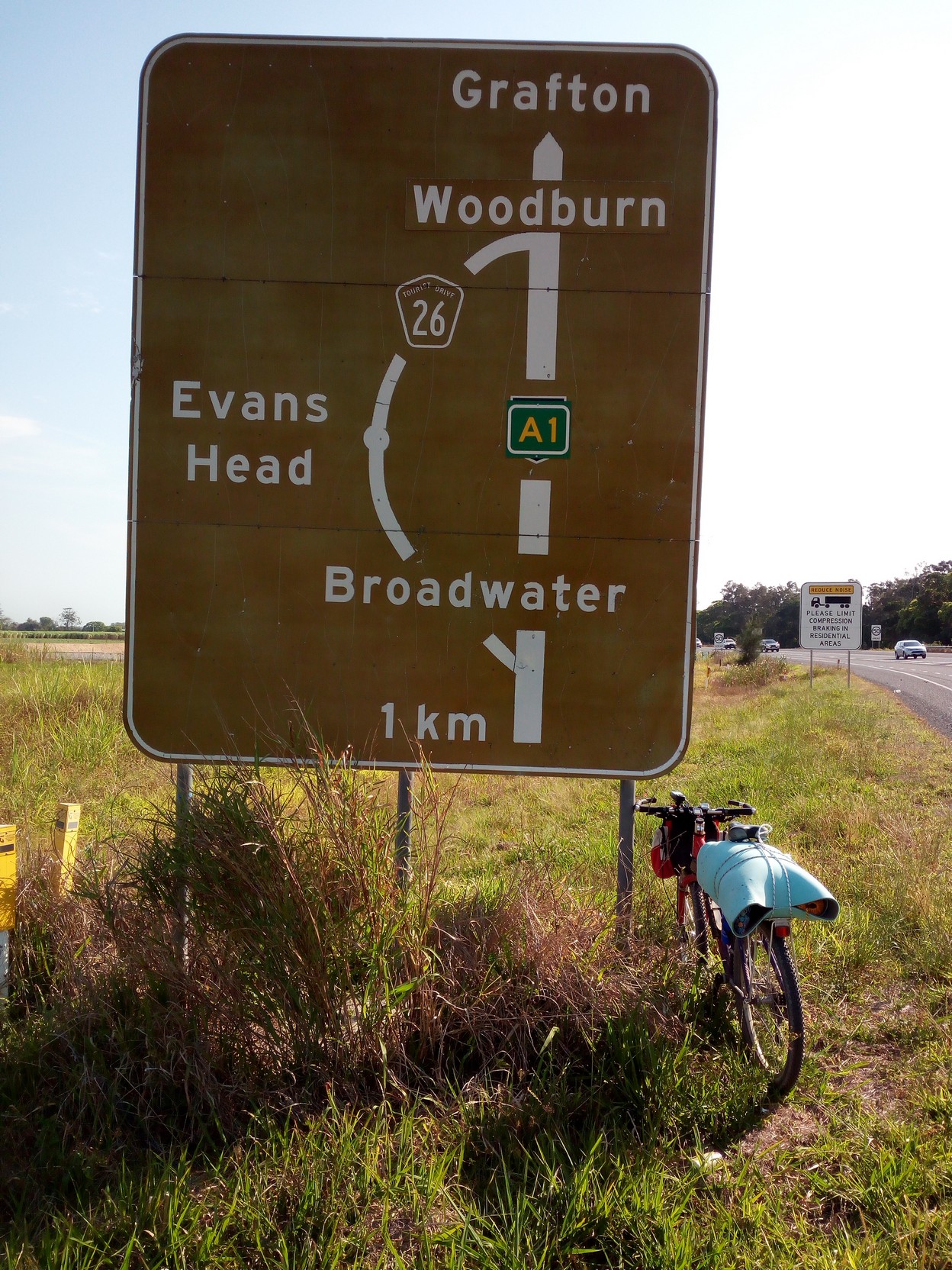
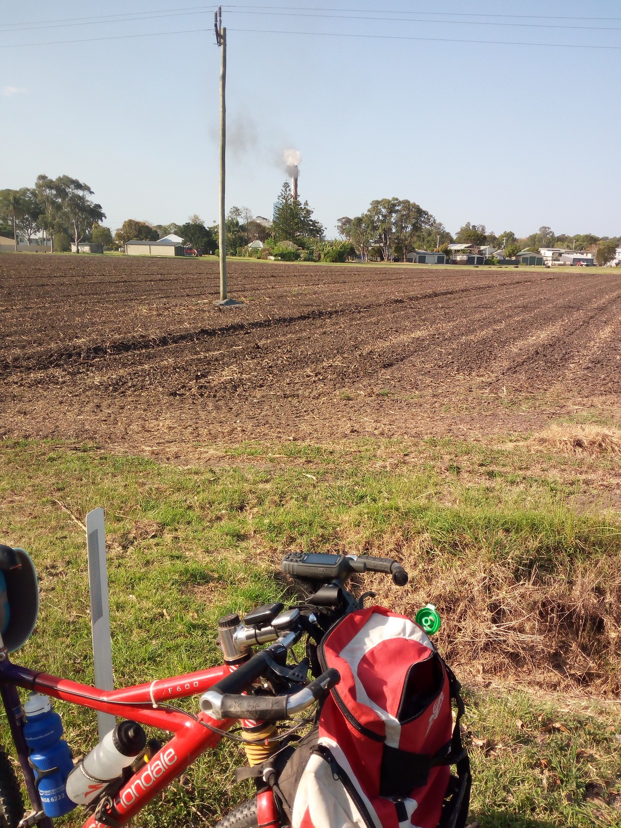
...then one sign suggesting the road (Meaneys Lane as it come off Sneesbys Lane, here) was private, but I suspect there's a public right-of-way. Interestingly, at this point, the beach is a short 750m south east through the scrub. Once through the backroads there's a short section of the Pacific Highway. In theory you could almost travel off the highway along the edges of the cane field's access tracks. There's a road sign - I'm taking the scenic route past Evans Head - something I haven't done in 42 years! Through Broadwater I face north for a picture of the Saturday cane season activity at the sugar refinery belching steam and black, sweet smelling smoke, from burning cane waste (bagasse).
|
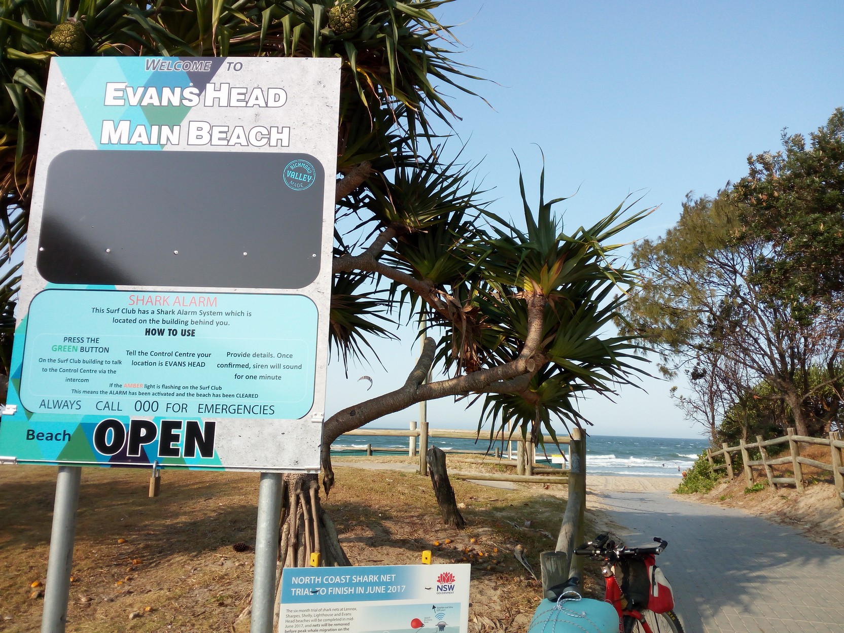
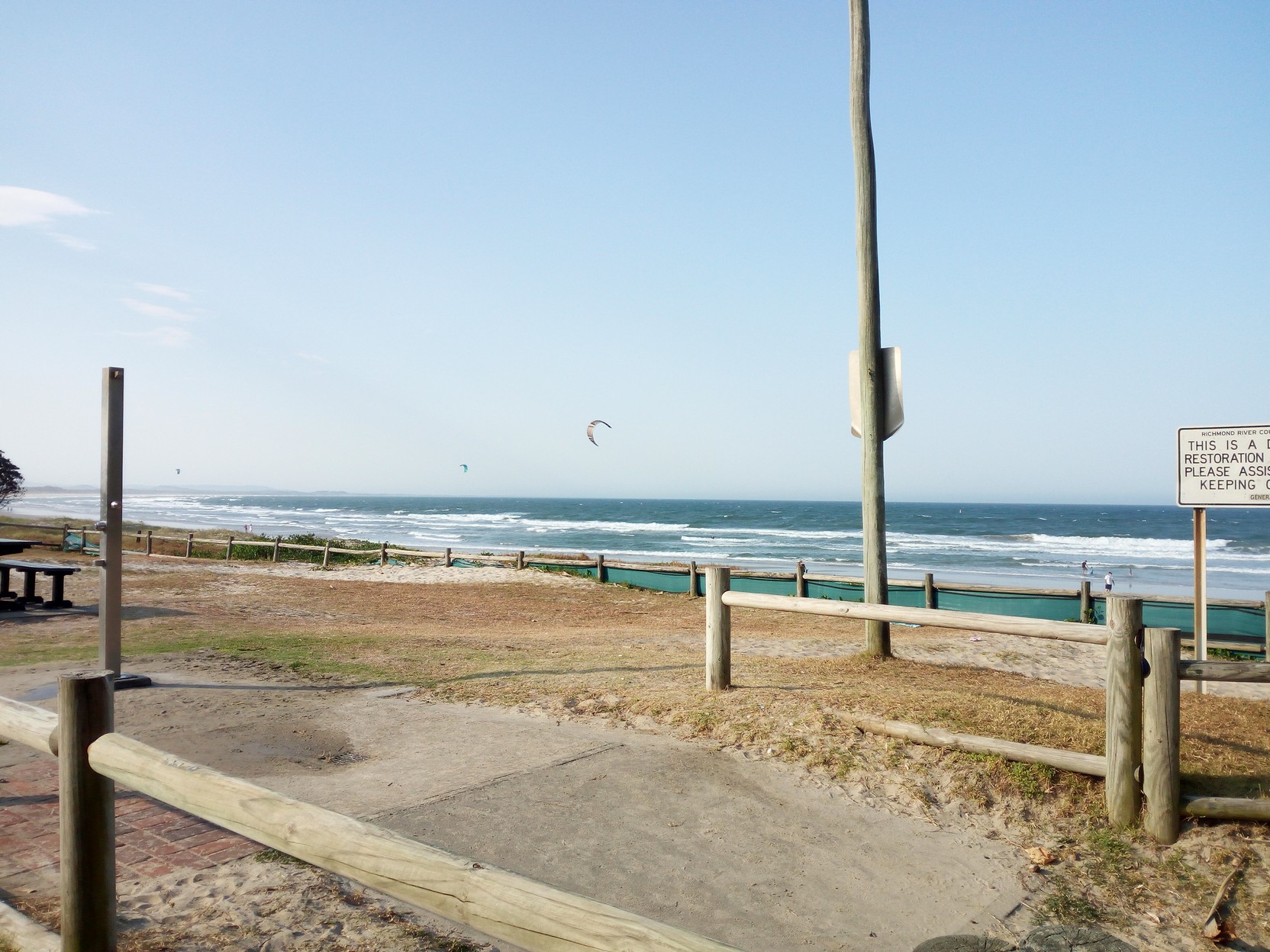
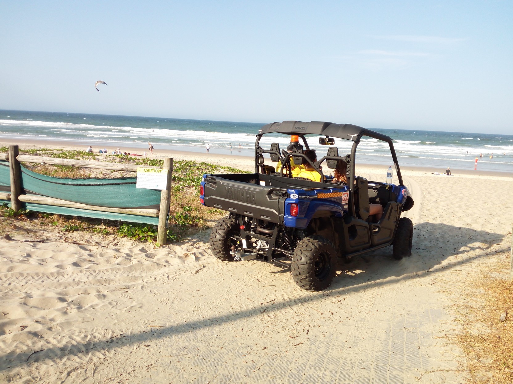
Broadwater via Evans Head to WoodburnNot having anything serious to buy (except perhaps some bicycle tube patches), and there not being too many places to buy anything from at Broadwater, but noticing the shadows lengthening, I pick the speed up (thinking to myself I've squandered the afternoon's tailwind with unnecessary photography). So, not stopping to photograph the good road to Evan's Head, soon I've arrived and the GPS track I'm following takes me past the Evan's Head SLC at Main Beach. I take photos of kite surfing, and also take a rare toilet stop and there's also a rare easy-opportunity to have a beach shower before continuing (and later that evening I regret not taking that shower)!
|
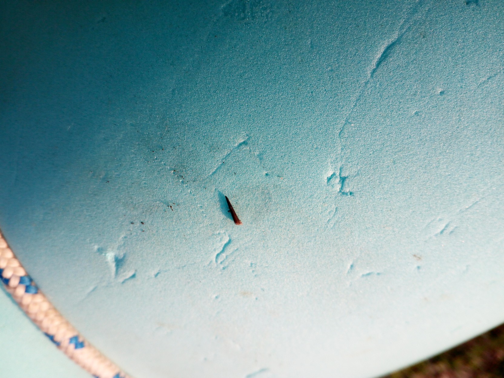
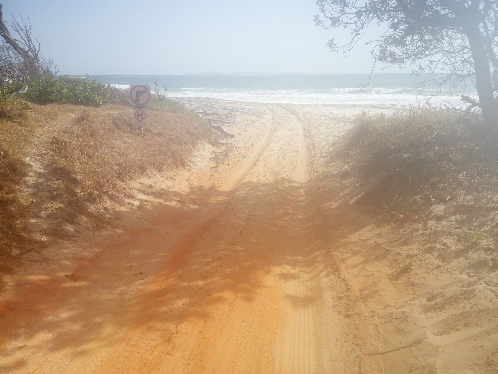
Woodburn to The Gap Road, and overnight campingI'm on my way to Woodburn and for a short period I have a headwind (the track has a large northerly component here, contrary to the sign back on the highway!). and I realise I haven't travelled anywhere near 100km in an afternoon for a long time (well, since April this same year). With Woodburn in sight, the rear end of the bike suddenly becomes squishy and I immediately stop to find a rapidly developing flat tyre (note thorn on my blue sleeping mat). Remembering I have no patches I try a bit more air in the tyre but it's coming out faster than it's going in so I give up and resign myself to a fifteen minute jog rather than a five minute bicycle ride into Broadwater - surely with a Caltex servo and an IGA supermarket, and school holiday travellers with bikes, I'll be able to bum a patch (or two)? 
It's getting dark, and at these higher latitudes, with the spring equinox just yesterday, the days are still shorter than I'd like. It's also pretty hot and not cooling off as it had just two weeks ago! Is this climate change in action?
A friendly football team (AFL?) travelling through town suggest the IGA sells bicycle patch kits (I secretly scoff at this suggestion and head for the street to look for travellers with bikes on racks).
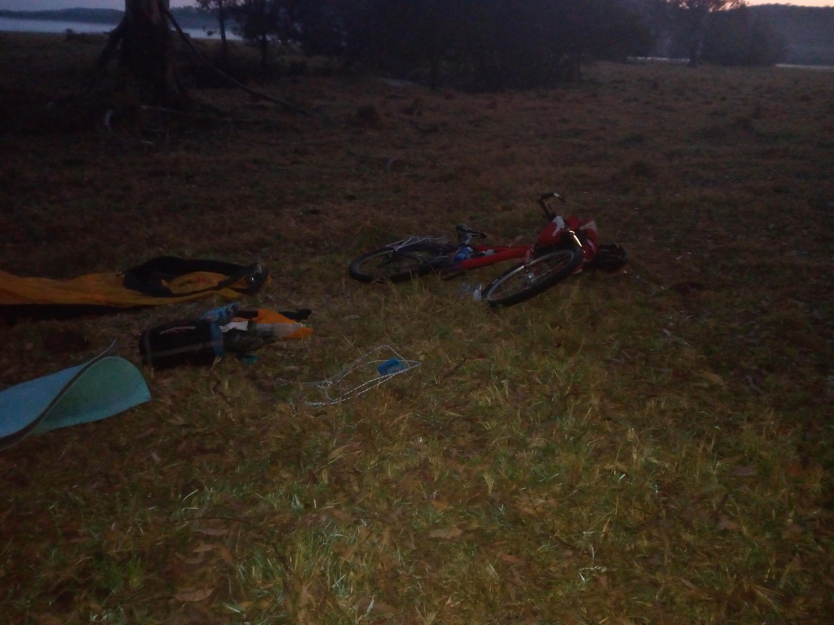
Of course the patch works but I forget I can't put the 2.2" MAXXIS Icon's back on while they are pumped up (the rim brake on my circa 1990s Cannondale is really designed for 1.95" tyres and 2.2" is way wider - I have newer front forks and a more modern disk brake there, but the rear only needs rim brakes!). It's not getting lighter and although I'm not hungry, I understand I will be when I wake up tomorrow. So I order a Burger with egg at the expensive cafe across the road that's still doing a roaring trade. I confirm that there's no caravan park nearby. While waiting for the burger to cook (this is no fast-food place) I go back to the IGA and wonder what I can buy that's light(ish), high energy, and tasty - I settle on a cellophane wrapped, 800 gram, light fruit cake, which will last for a few days should it have to. I hesitate at the purchase, remembering previous times when I've quickly tired of this "food", but it is convenient. Back at the cafe I collect my burger, cross, the street and replenish my water at the public tap, then get out my handheld torch (I'm not using my Shutter Precision dynamo because the regulator is still in a box that I haven't located yet after a recent move!). Then I semi-one-handedly ride south into the increasing darkness. Destination is just a couple of km along the Pacific Highway but I'm stopping when anything bigger than a small sedan is heard behind me, and getting off the road. This works well and in only a few minutes I've made it to a truck-stop/side-road that morphs into to The Gap Road ahead - this is on my GPS trail and I occasionally hit the "enter" button on my GPS to briefly turn on the backlight to check my progress. Considering where I'll stop for the night, I take the first road off the truck-stop/side-road, with the expectation I'll get away from the highway. But inadvertently I choose a short no-through-road and subsequently backtrack to the main road and continue to The Gap Road which I travel along until the sound of growling trucks from the highway are just a memory. I quickly get to the end of this sealed road and realise I can't travel on a loose surface without good lights, so I go back a few hundred metres and hive off into an open field. I use branches as props under the four-strand barbed wire fence, and drag the bicycle under it, and into an opening away from, but surrounded by, large eucalypts. I'm in a field by an almost dry seasonal stream, and the thin smiling crescent of a fast setting new moon quickly becomes dimmer than the Milky Way above. The distant glow of street lights from Woodburn and Evans Head give a unique red aura to the northern horizon. That burger is so good - it's still warm by the time I get to it, and for desert I even start on the fruit cake. I toss and turn all night in my cramped tent that I know will be dripping in the morning. I'm amazed at the unfamiliar dialect of the local possums and owls, but I awake before sunrise and pack to be off before I'm embarrassed by someone wondering who I am in their field. |
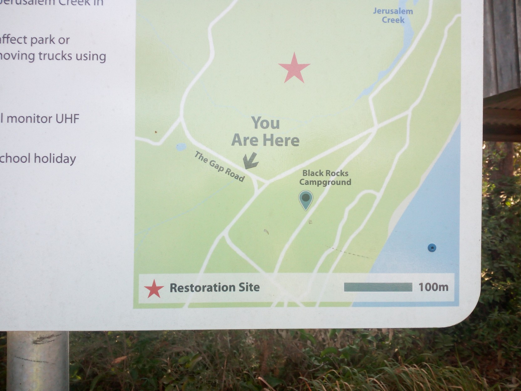
Day 2 - Camp (5:45AM) to Black Rocks CampgroundI have in my backpack cable tied to my handlebar (this is bikepacking in the raw!) a packet of muesli bars that are out of date by over 12 months, but the fruit cake is more appetising and I consume perhaps a third of it - breaking chunks off to eat while I pack! I've come about 97 km along the GPS track but my odometer says over 106 km because I did a bit of backtracking (overshooting a turn or two!) and in-town cycling. The sun rose over the horizon just over 10 minutes ago and I'm on the gravel road making good time along The Gap Road towards what I think will be just a couple of hours until Iluka.
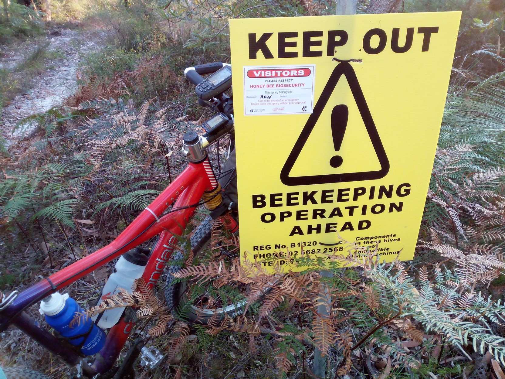
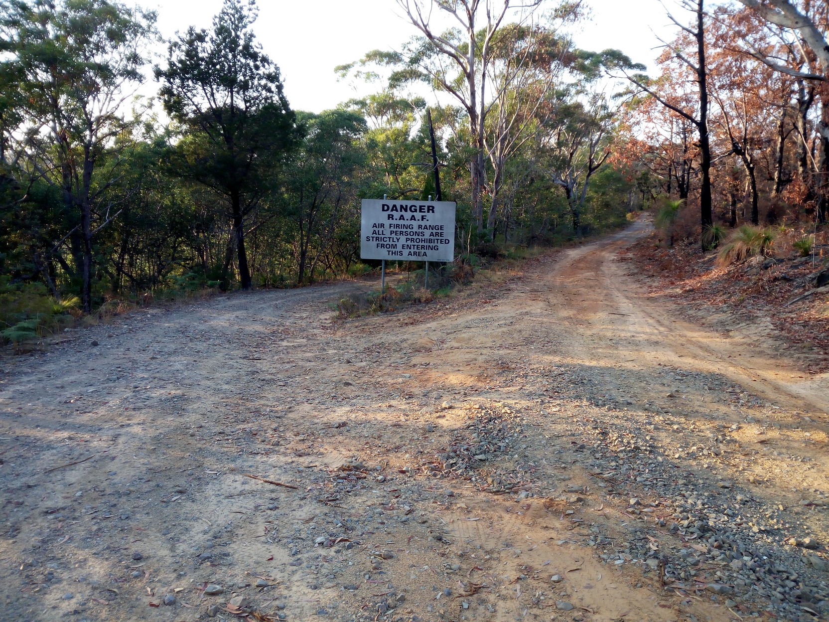
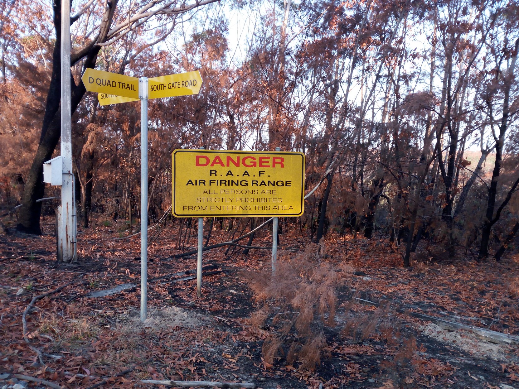
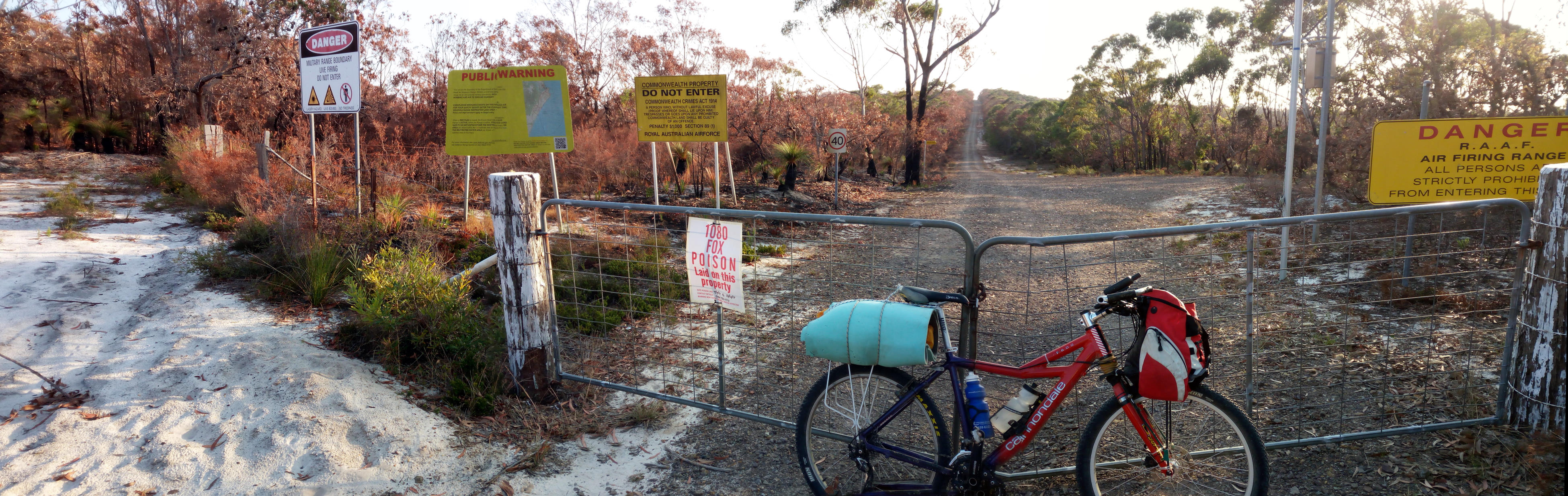
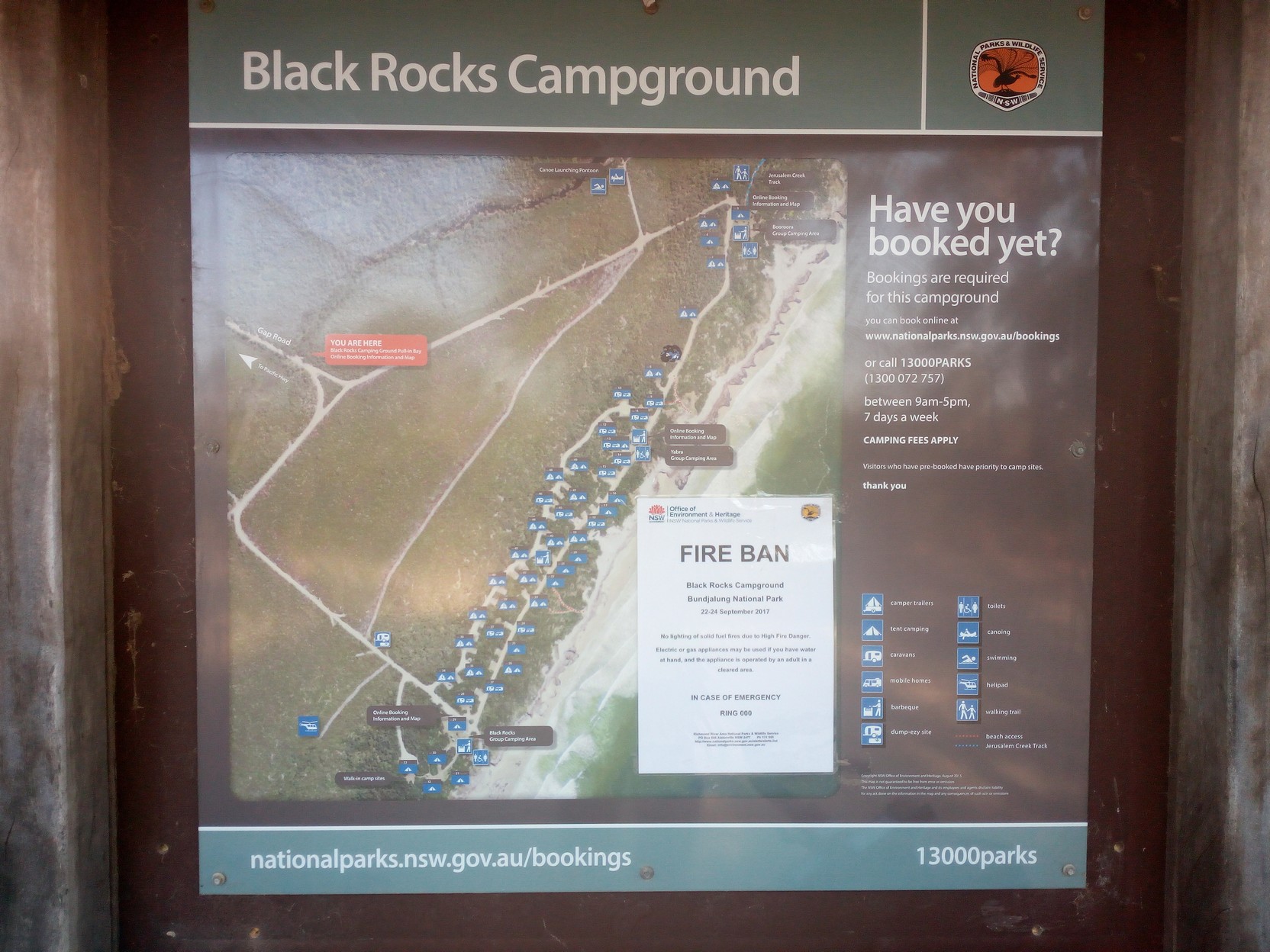
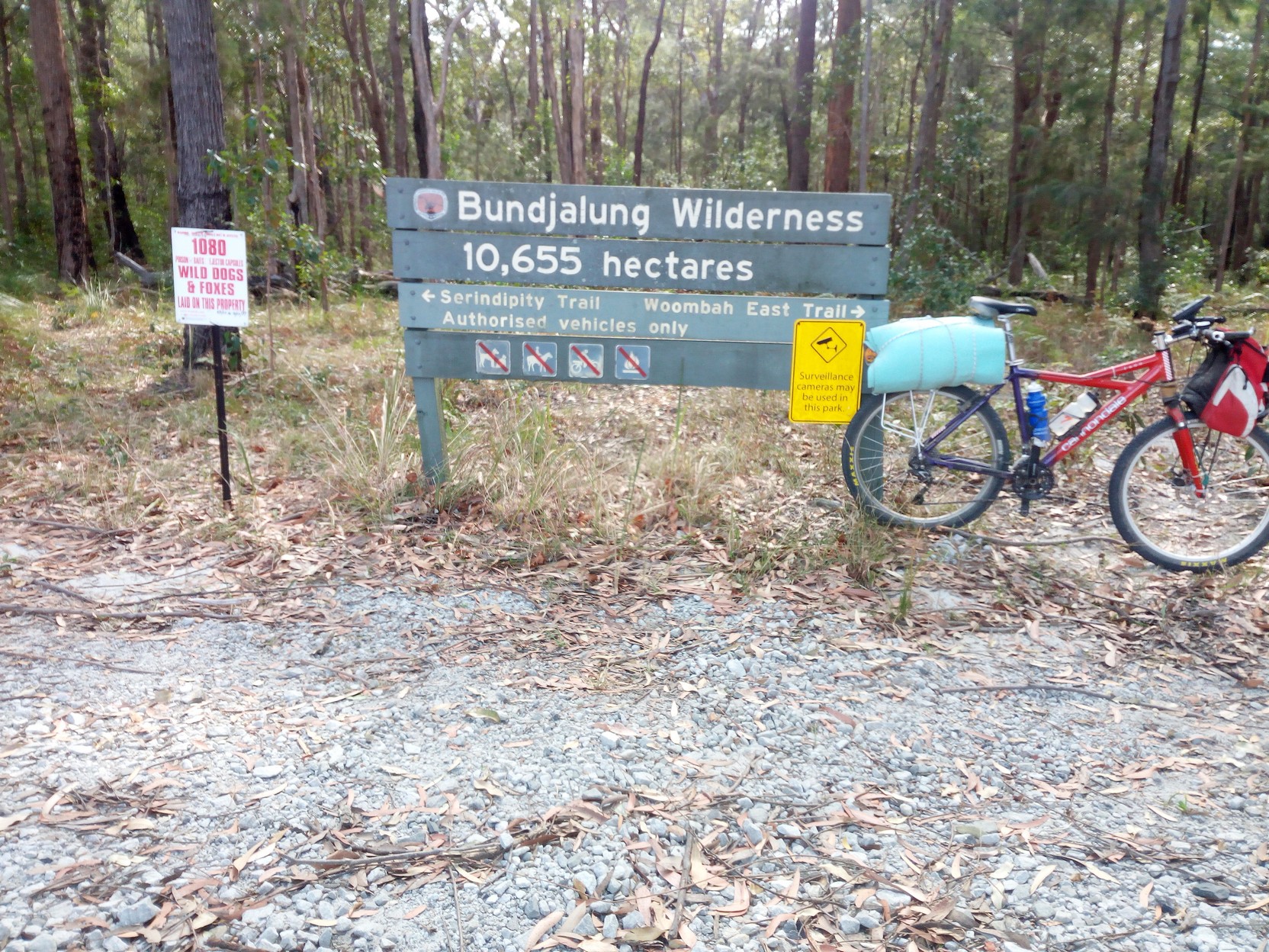
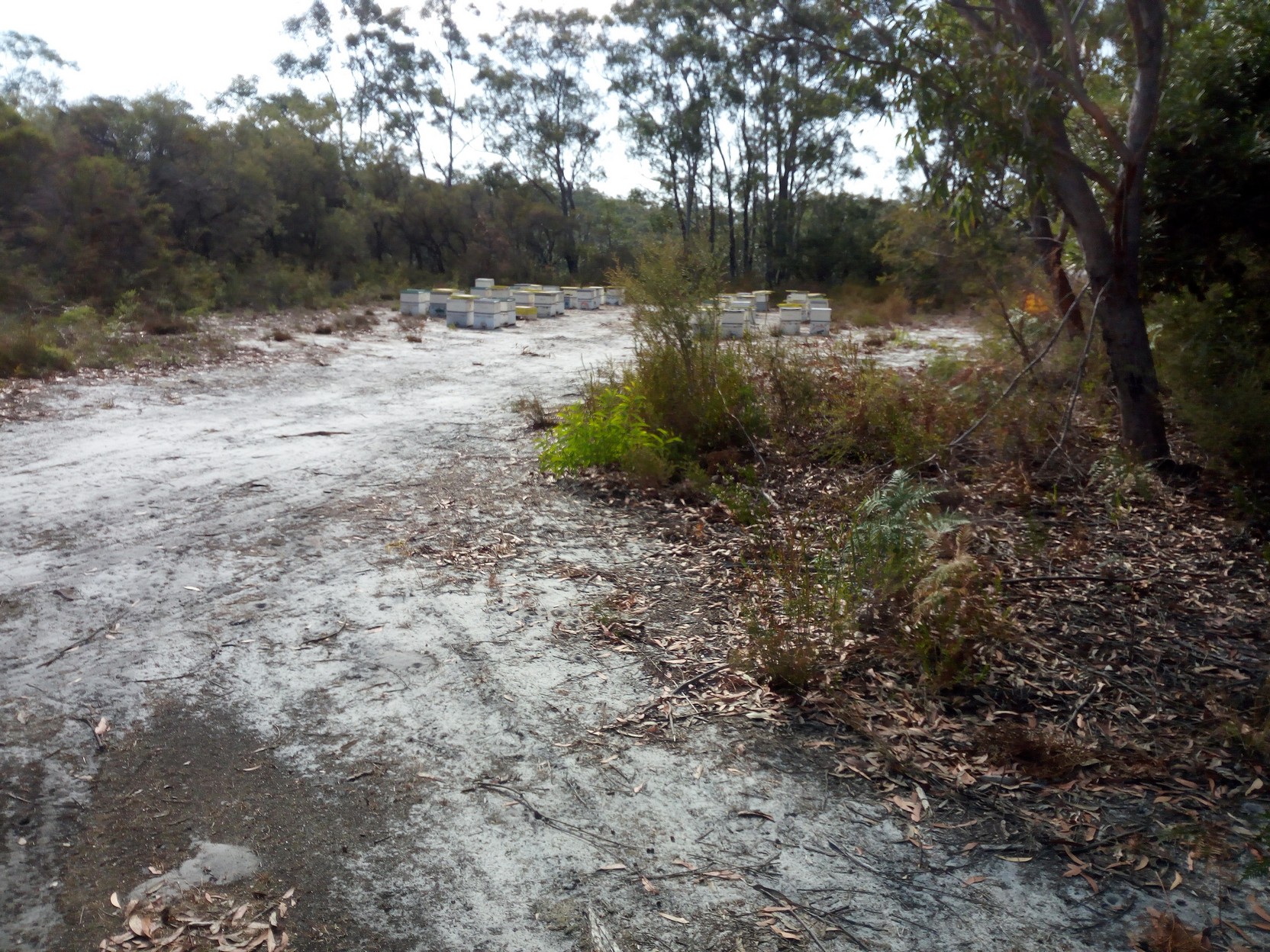
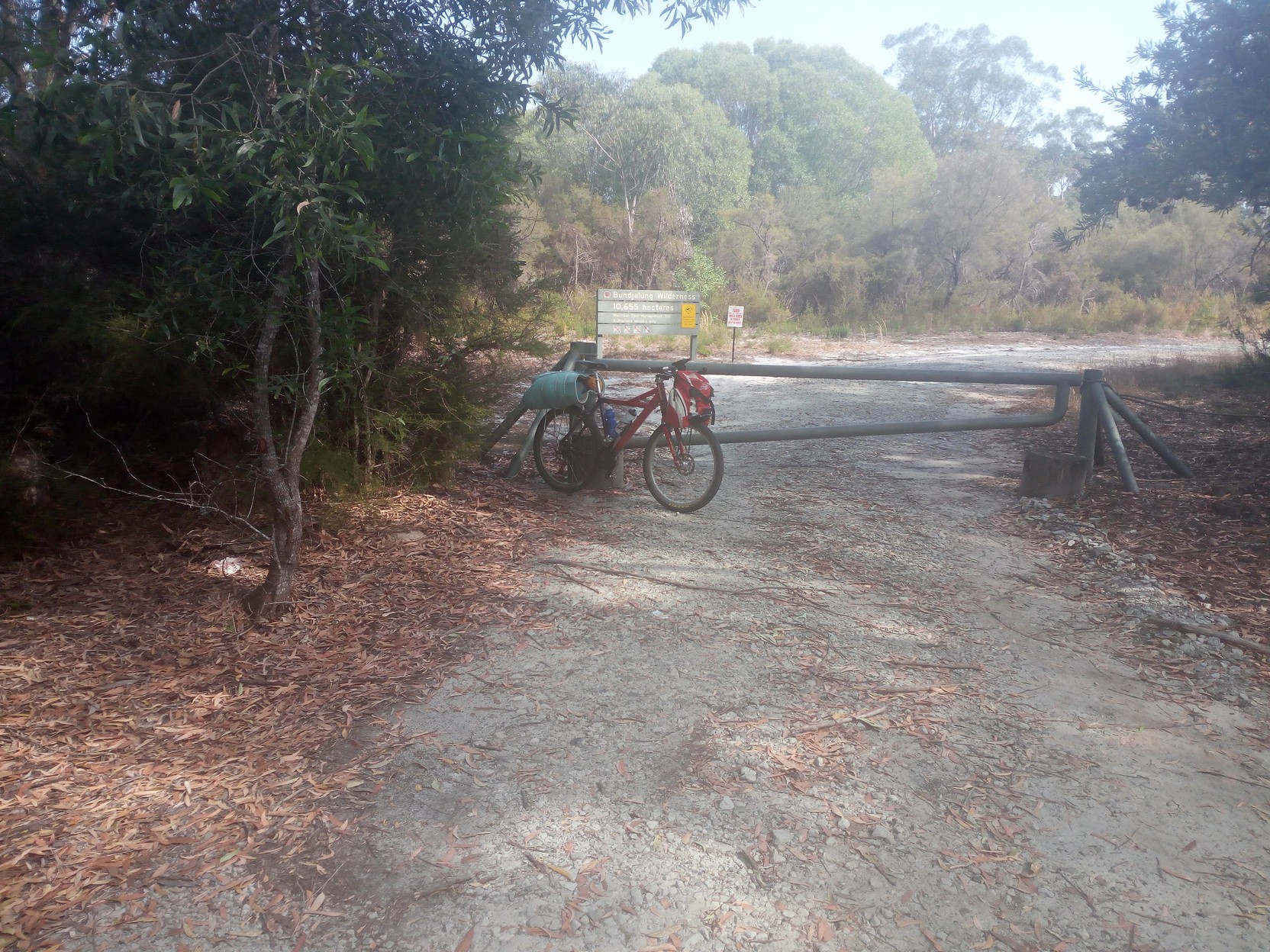
I get off The Gap Road just as it makes a hard right and immediately I stop because there's a sign suggesting there's a beekeeping operation I stop to investigate. Just a bit further along I'm confused whether the track goes left or right - I play with the zoom on my Garmin GPSmap62 but the trees still make it difficult to work out which fork to take. I eventually take the right fork and I'm confronted with a locked gate and lots of signs suggest I'll die (through being hit by missiles, laser light, or I'll eat 1080 poison) if I try and proceed through what's described as an RAAF live firing range. Look, it's early Sunday morning (6:20 AM) and I take my chances and start cycling along South Gate Road which I understand is the western border to the range. I wonder if, at any instant, a large Unimog will suddenly appear and run me over. But I make it to the next locked gate (both of which I simply push the bike around - no lifting over a gate required!). I've been cycling along good, mostly gravel, level roads with just the occasional gentle climb or fall. I continue until the Black Rocks Campground, and overshoot a corner where my track goes straight ahead through a low 4x4 barrier.
|
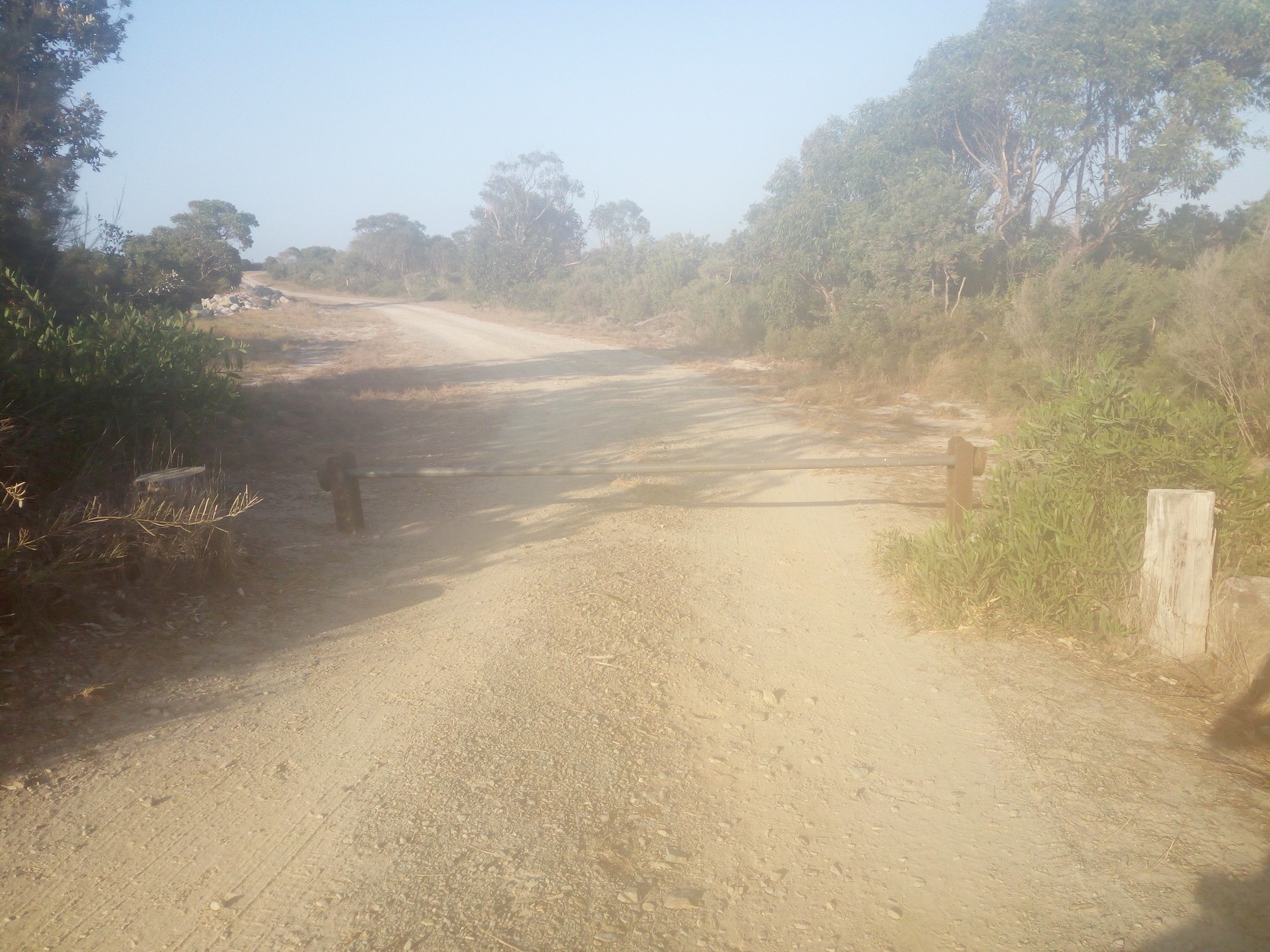
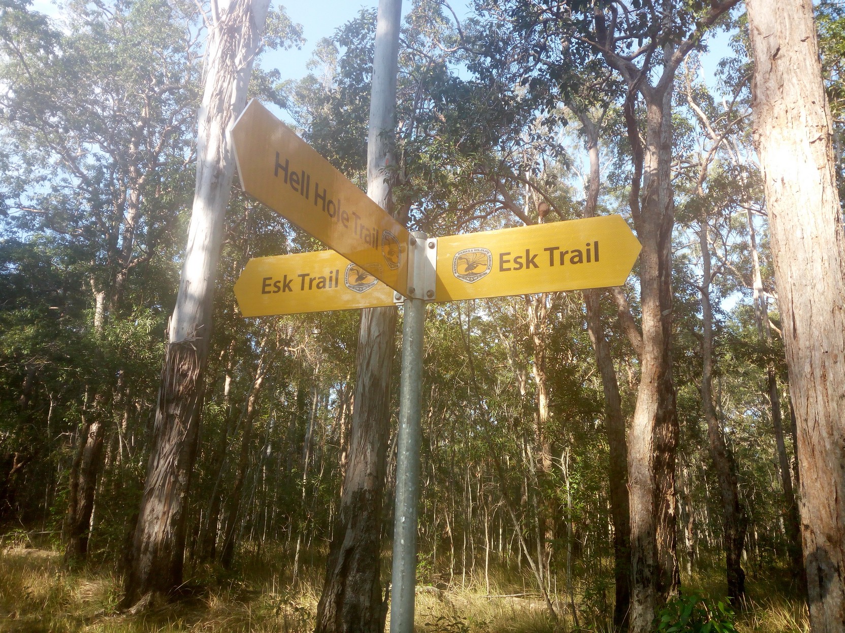
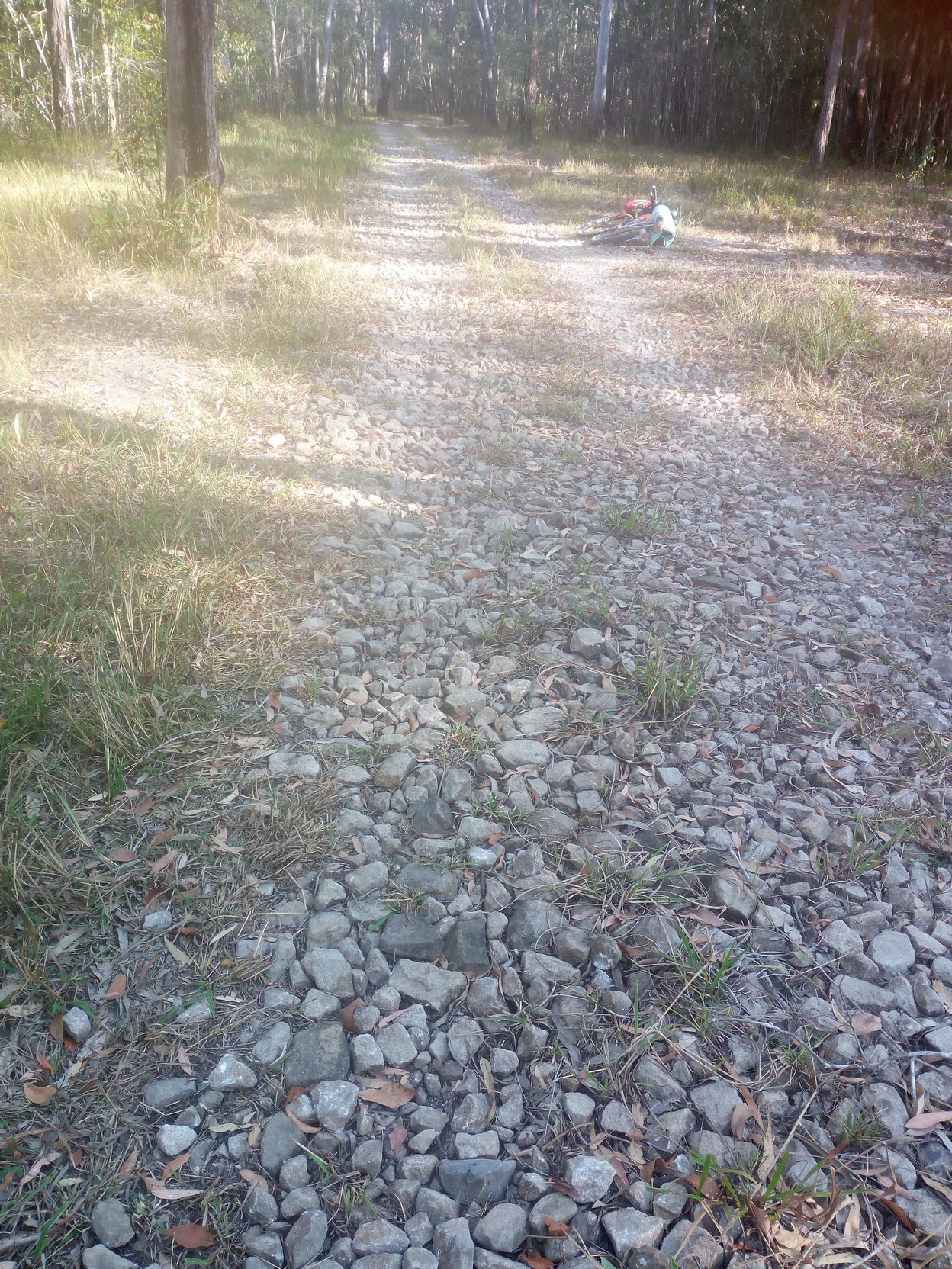
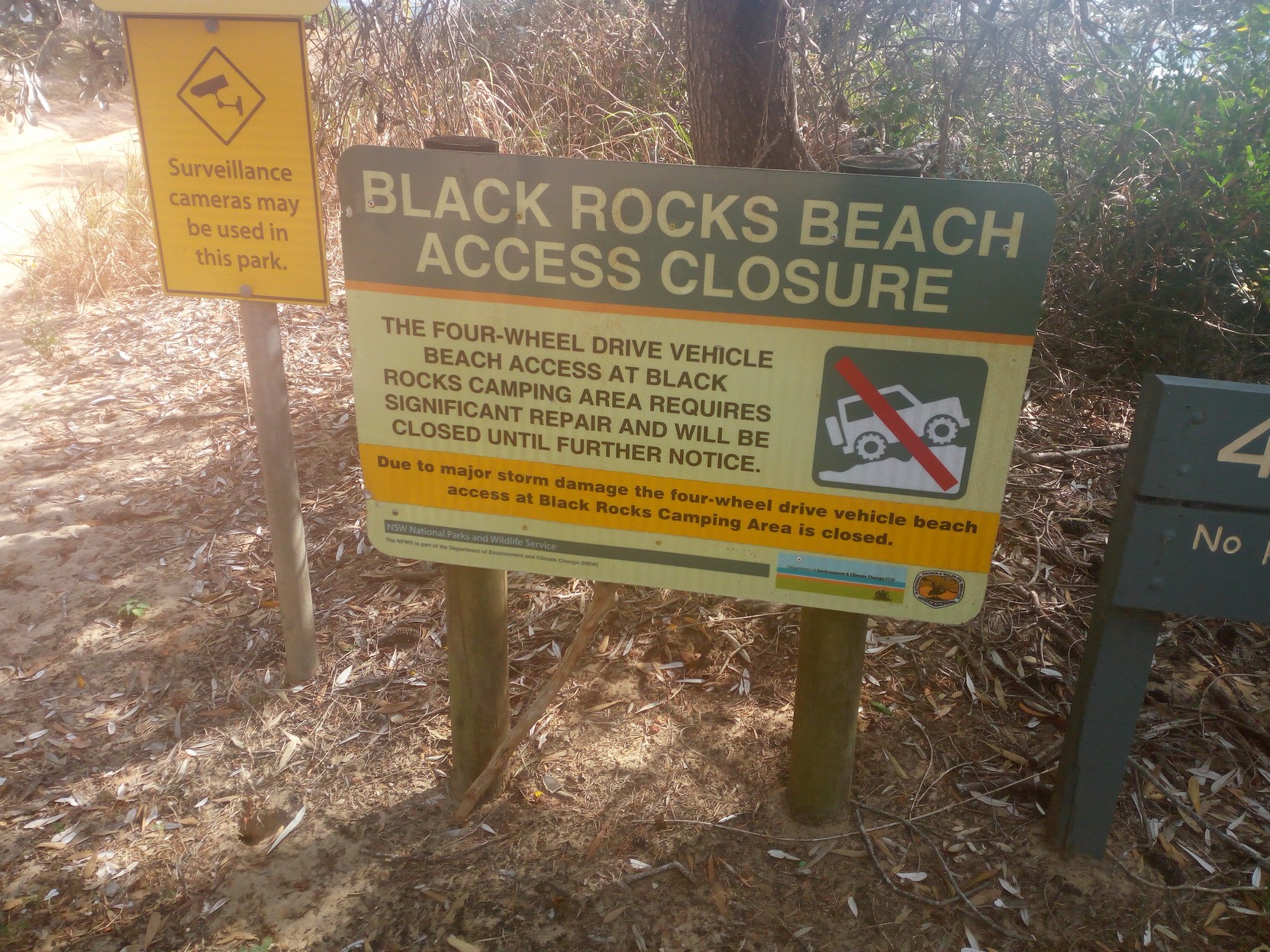
Black Rocks (campground) via Esk River bypass, to IlukaBy this stage my phone, which may have collected some condensation overnight, has moisture on the inside of the camera lense. You can see the fuzzy result of this in the next few photos! Until now the road has been fast and flat and I've been thinking about arriving at Iluka soon, but now it has become a lot rougher and I waste five minutes repacking my overnight equipment that has rattled off the rear rack. The photos show the condition of the track (and of my phone/camera) - those rocks look innocuous enough, but it's slow work as they are not well compacted and they go for a surprising distance. A sign off to the right points to Hell Hole Track, but am I on it already? I start to wonder about catching the second ferry from Iluka, rather than the first for the day...
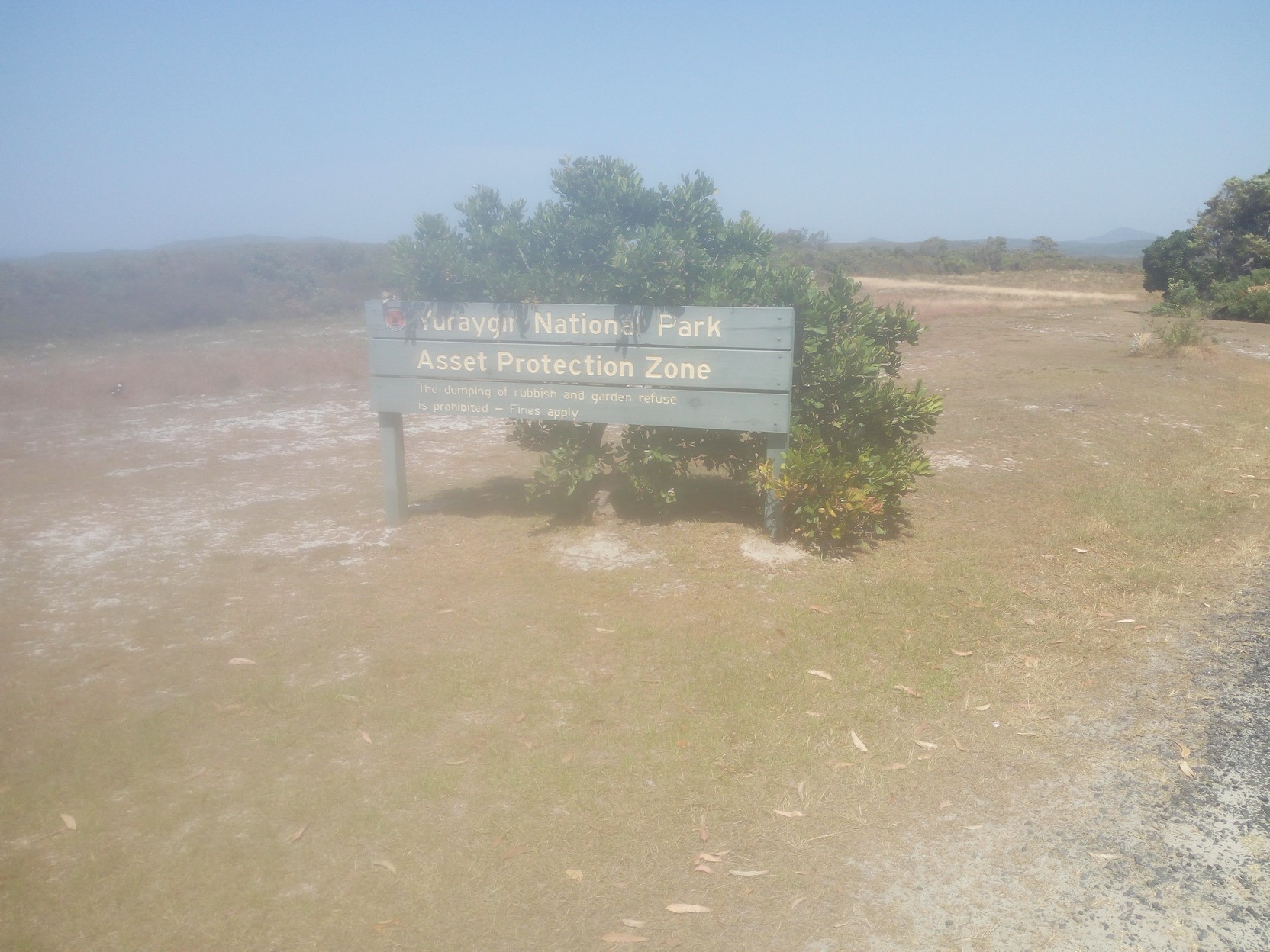
The rocks strewn across the track are there for a purpose - there is evidence that this area can get very wet and boggy when it rains, and the rocks allow drainage across the track and extra purchase to 4x4 wheels, but they are not too bicycle-friendly. I'm thankful that the surrounding area is currently in a protracted dry spell, as is much of the north east of NSW. Further along this track through Bundjalung Wilderness there's a lot more white sand to be seen - a warning of what's to come perhaps? This track (Serendipity Trail, an oxymoron perhaps?) eventually pops out onto the black-top of Iluka Road and almost immediately crosses the Esk River with signs warning of "Road subject to flooding". Iluka Road comes from the Pacific Highway just north of Mororo Bridge across the Clarence River (note how we have move south from the Richmomd River valley) and is the northern approach to sleepy Iluka. A few km further along I reach the beach and the (closed) beach access road north to the Black Rocks camping area (which is roughly 12km north along the beach, and which I passed just over two hours ago, although I took the inland back-roads, not the beach). Further along Iluka Road, Iluka itself appears and I have plenty of time to catch the second ferry for the day leaving at 10:15AM.
|
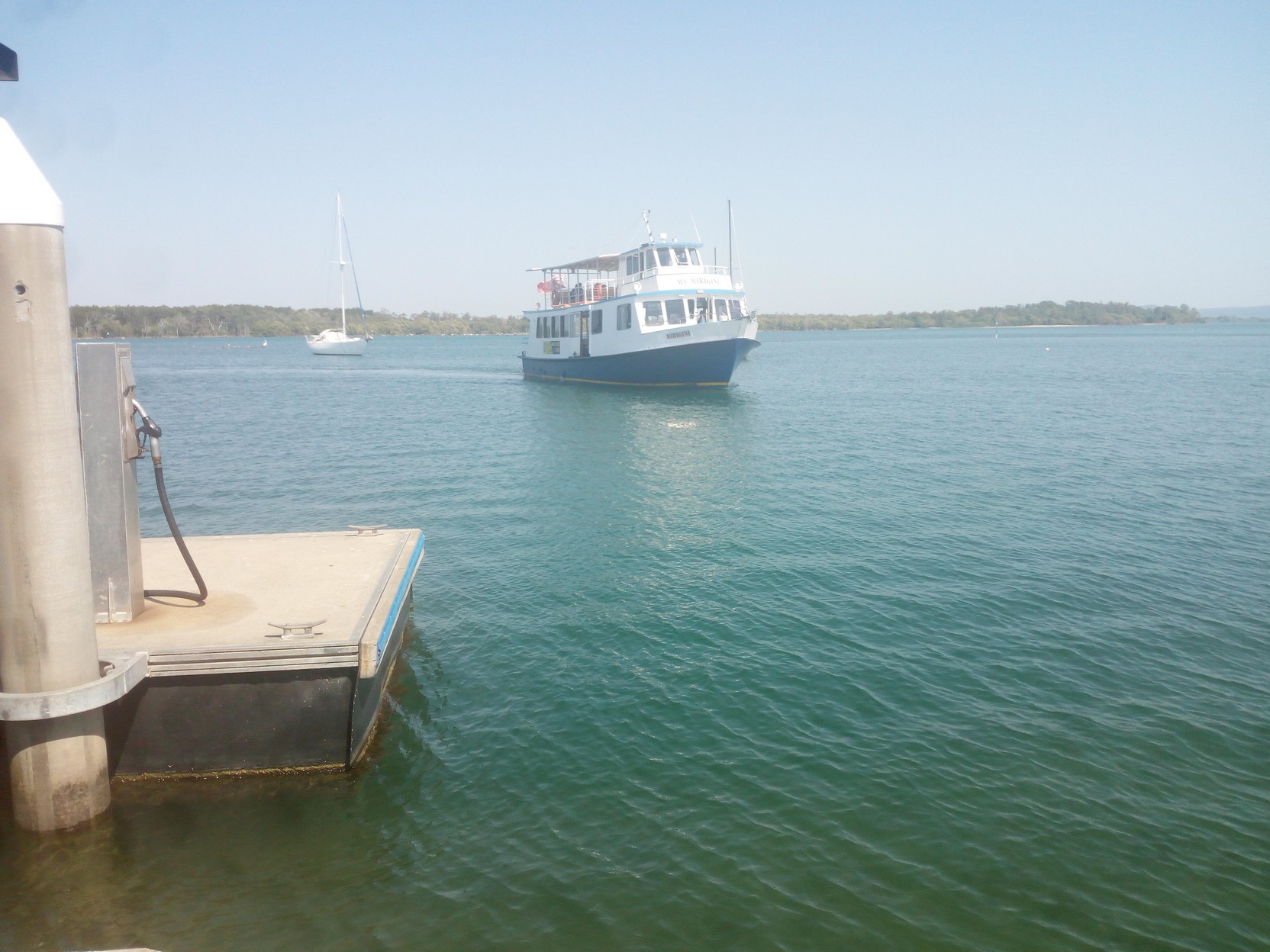
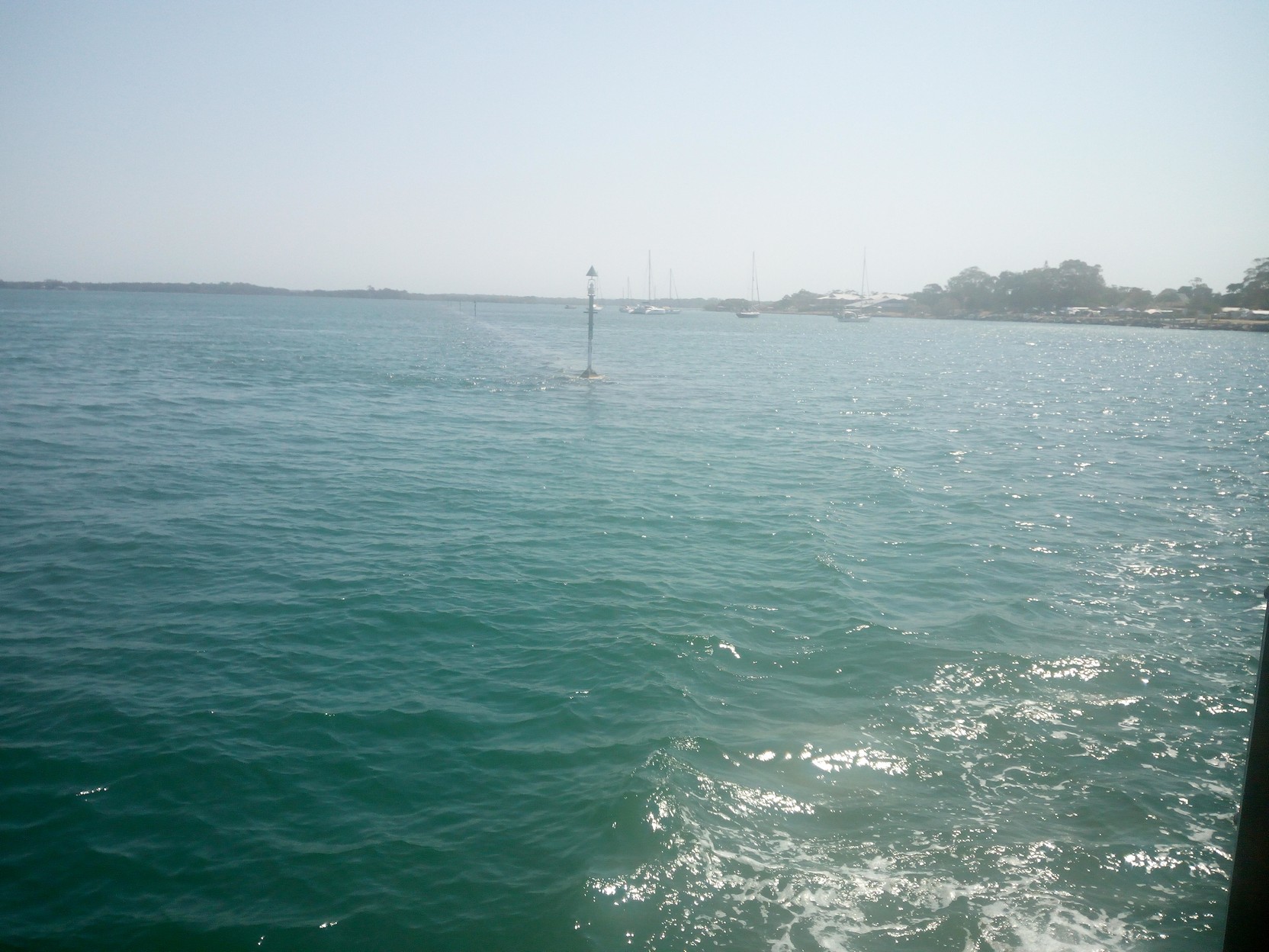
Ferry Crossing & Iluka to WooloweyahThe ferry crossing to Yamba on the MV Mirigini, (which originally serviced Palm Beach NSW) was interesting - there's a very long breakwater across the Clarence River at a very acute angle - it's a busy river! A 240 Volt supply on board the ferry allowed me to recharge my Bryton 310 that was recording the trip. Without a regulator on my bike I was relying on my phone lasting three days (easy!) and a spare set of batteries for my Garmin GPSmap62sc that held the GPX track I'm following. I flashed my senior's card and received a 50% discount on the journey, meaning it was just over $4.00 - The ferry is a passenger ferry, and there's no space for vehicles (bikes go in the area behind the seats on the lower deck - the same deck you enter on).
Now at Yamba I scouted around a little and bought some fruit, and spare batteries for the Garmin. At a cafe (Wato's Fish & Chips near the large roundabout in High Street) I bought a large fish burger - it had a slab of cheddar and a whopping iceberg lettuce leaf and some other vegetables too - it looked great. I was offered free cool water from bottles at the bottom of the fridge - an offer I couldn't refuse! I'd already had a cappuccino at Iluka recently and I didn't want to suffer caffeine withdrawal later, although it did take some willpower! There was at least an hour to go before lunchtime so I stowed the fish burger but had some fruit. It was time to head south along the bitumen, and I made it to the track immediately south of Wooloweyah at about 11:30AM - which was almost the same time I'd left from Byron Bay the previous day - so in a 24 hour period I'd travelled, across pretty easy tracks and a fair bit of bitumen, just a bit over 157 km according to the track I was following (of course my bike was showing 160+ km!). note: If you are in a hurry and you have left Byron Bay early in the morning, then you may be able to get to Iluka (about 148km) before the last ferry leaves Iluka for Yamba at 4:00PM (Ferry times south are 8:45, 10:15, [13:00 but not on Wed. & Sun.], 14:30, 16:00).Continue reading on page two, (or back to the introduction). Page last updated 27 Feb. 2019 18:10 (east/west, some directions, grammar etc. fixes!). This story (text and photos) is © Copyright Peter GARGANO, 2019. |